The Jomolhari Journey is a famous and gruelling high-altitude trek through towering peaks that everyone wishes to experience. It is longer than the Jomolhari Loop, which is one of Bhutan’s most popular trekking routes. It offers amazing views of the mountains and passes through lovely alpine landscape on the route to beautiful campsites (2,500m – 5,000m). This walk also passes through a number of semi-nomadic settlements.The ideal months to go on this hike are spring and fall.
With good cause, the Jomolhari trek path is Bhutan’s most popular trek route. The environment, vegetation, and animals are diverse, attractive, and rare, and you’ll pass through a number of remote and unique villages.
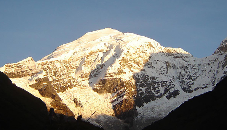
The stunning view of Mount Jomolhari (the world’s highest unclimbed peak) from Jomolhari base camp (Jangothang) is the main highlight. This article will discuss the route in detail so you can know what to expect and be prepared.
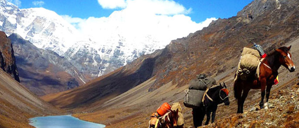
It’s worth noting that you’ll be escorted by pack horses, who will be carrying your camping gear. In the upper elevations, these could be used in place of yaks.
Day 1 : Gunitsawa Village – Sharna Zampa.
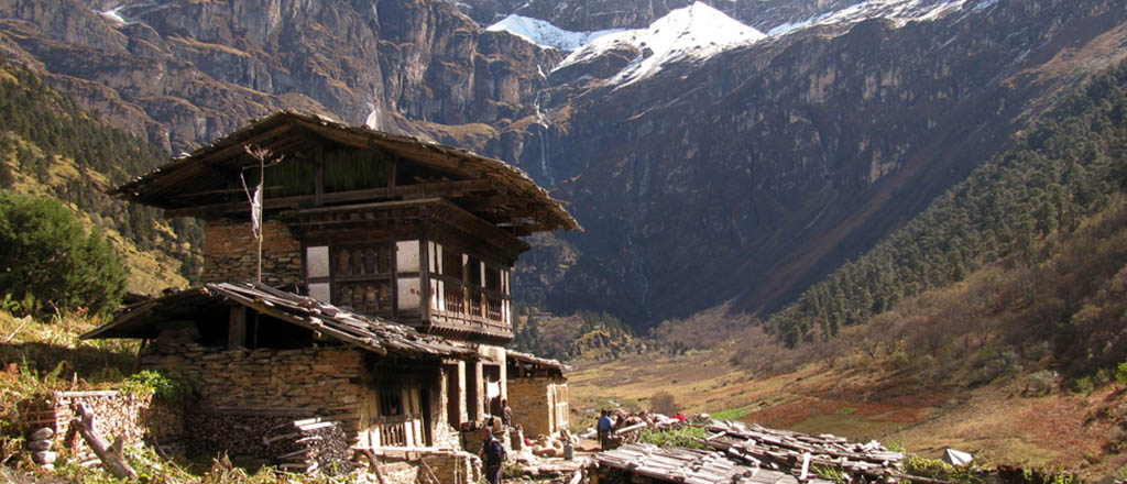
This hike starts at Gunitsawa Village, where you will pass by an army base. Your trek permit (issued by Druk Heritage) will be verified and endorsed at the army check post. The campground is located on the opposite bank of the river, close to Gunitsawa.
The trail ascends gently via millet and rice terraces, passing through blue pine and fir, reaching Shanna Zampa at 9,348ft/2,850m.
Day 2: Sharna Zampa – Thangthangkha.
The trail is still full of minor ups and downs . After ascending the river valley, the valley progressively narrows to a single road that leads to a meadow where a tent will be put up. It’s also muddy on the trail. The scenery, on the other hand, is really breathtaking.
You’ll have to stroll along the Paro Chhu, crossing it on wooden bridges at times. Rhododendrons, ferns, oaks, larches, blue pines, maples, birches, firs, and cedars can all be found along the trail.
The clearing near the stone house Shing Karap is a popular lunch destination since it provides a break in the trees with a spectacular view.
If the weather permits, you’ll get your first magnificent view of Mount Everest from here.
Day 3: Thangthangkha – Jangothang.
If you haven’t seen Mt. Jomolhari (which spans the Bhutan-Tibet border) the night before, you’ll still have a chance to see it this morning. The hike continues this morning up the Paro Chhu valley, which opens into sections of alpine grassland and sparse tree growths.
Along the journey, you’ll pass through an army checkpoint and be treated to a stunning view of high mountain ridges and snow-capped peaks (you’re not far from Tibet, and the location has a lot of military history, which your guide can tell you about).
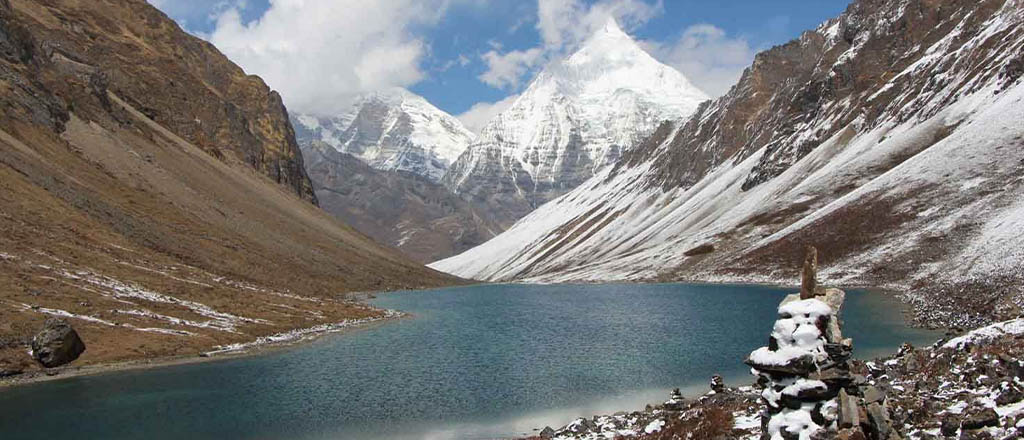
Yaks and their herders’ huts are a regular feature of the landscape in this area. You’ll also pass through Soe, Takethang, and Dangochang, which are all rural communities. You’ll enjoy another amazing view of Mount Jomolhari after arriving at Jangothang – one of the most stunning campsites in the Himalayas.
Day 4: Jangothang Halt.
Day hikes with spectacular views of lakes and snow-capped mountains such as Jomolhari and Jichu Drake. On the valley’s upper slopes, there’s a good chance of seeing some blue mountain sheep.
Jangothang is one of the most beautiful sites to camp in the Himalayas. The eastern side of the Paro River, which is a small stream here, is formed by a chain of snow peaks, and there are Yak herders, settlements, and trout-filled lakes to explore. You may climb to the Jomolhari glaciers, or to Tshophu Lake for spectacular views, fishing, or exploring nomad huts and communities. You can, of course, choose to stay at camp and relax while taking in the scenery.
You can also hike up to Tosoh or around the surrounding area. In three directions, there are decent short hiking paths. To the west, the Jomolhari and its subsidiary mountain systems, the Jichu Drake to the north, and a number of unclimbed summits to the east.
Day 5: Jangothang – Lingshi.
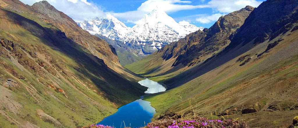
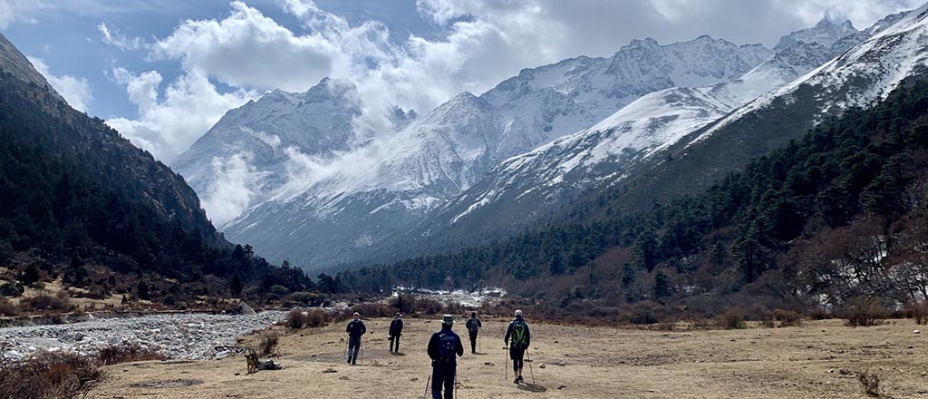
Today’s journey features a significant elevation change. You will leave Paro Chhu valley and enter a moraine-filled glacial valley. The scenery is quite different here, with juniper shrubs, grass, and tundra. Views of the many mountain summits can be found at various spots.
After passing through Tshophu Lake (4,380 metres), you’ll climb rapidly to Bhonte La Pass (4,890 metres), the highest point on this trek route. After that, we will travel downstream from the Dhumzo Chhu river, through the few dwellings of Soi Yaktsa (Dhumzo), to arrive at your tent shortly after.
Day 6: Lingshi – Shodu.
Because today will be a long day, getting up early is vital. We’ll start by climbing out of the valley and up onto a ridge. You’ve been travelling north east up to this point, but now you’re heading south towards the Mo Chhu valley.
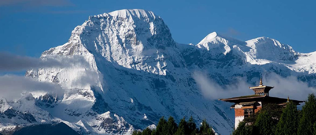
You must ascend up to Yeli La after hiking down Mo Chhu valley. The pass is a tiny cliff route carved into the face of a rock. Mt Jomolhari, Mt Tserim Kang, and Mt Gangchhenta (‘Great Tiger Mountain’) can all be seen on a clear day.
You enter the upper Wang Chhu valley near the end of the day’s trekking and reach Shodu Camp a little further on.
Day 7: Shodu – Barshong.
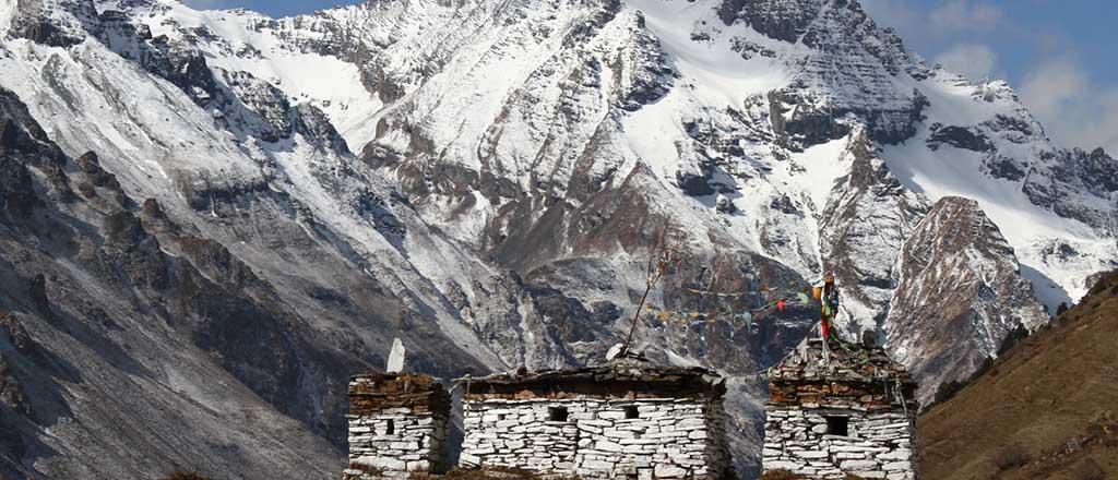
It’s an easier day of trekking today, with more descending then ascending. Early on you pass under some yellow cliffs that have meditation caves carved into them.
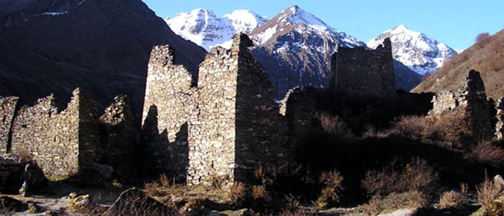
The trail follows the Thimphu Chhu through rhododendron forests, past beautiful waterfalls along the way. The valley narrows till the path takes to the slopes and gradually ascends to the ruins of Barshong Dzong.
Day 8: Barshong – Dolam Kencho.
The trail descends down to the Thimphu Chhu river valley, through dense forests of rhododendron, birch, conifer, maples and bamboos and then ascends to pasture lands.
Follow the trail and you will soon reach Ta Gume Thang (Waiting for Horses), a clearing at 3,370 m for camping in a meadow.
Day 9: Dolam Kencho – Dodena
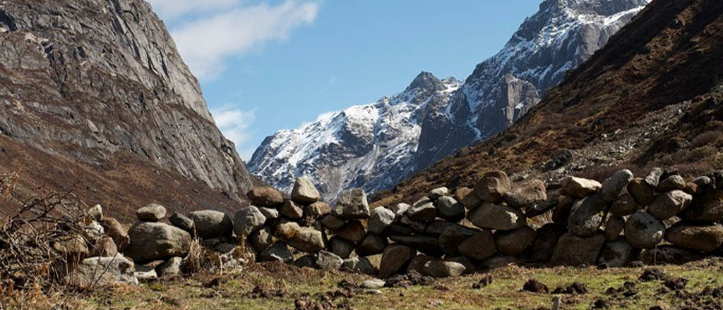
The trail continues through forested areas winding up and down and through a small pass. Langurs (monkeys) can be seen along the way. In Dodena, you will exit the Jigme Dorji National Park and reach the road head next to an impressive cantilever bridge.
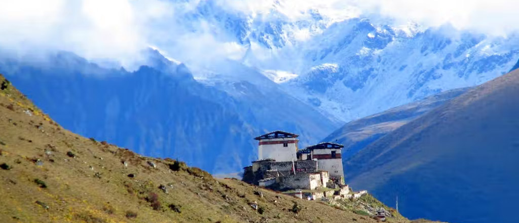
That’s it! You have come to an end of your Jomolhari Trek. The trek finishes at the beautiful Cherri Monastery, while it is a 40 min hike to the monastery it is well worth it.
Best time of year for the Jomolhari trek. From a weather standpoint, spring (April to June) and fall (September to November) are the ideal times to go on the Jomolhari trek . However, the walk can normally be done at any time of year, as long as the high passes are not closed due to snow. If you prefer a more peaceful trek, go during the off-peak season. However, be aware that walking in the rain can be extremely difficult.
As previously said, you cannot walk alone, so if you opt to do the Jomolhari trip, you will be accompanied by an expert guide.


Comments are closed